Parks
The City maintains several parks throughout the community. The Parks and Cemetery Supervisor employs a number of seasonal workers to ensure all of the parks are maintained. A brief description of the City’s parks follow:

Covell Park is a 3.9 acre community park. The park provides access to White River and it is primarily used for fishing. Picnic tables and grills are on-site. Boat launch to White River to paved parking.
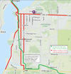
» Map & Directions (310 Thompson Street, Whitehall, MI)
» Schematic & Amenities
Funnell Field is a 12.6 acre neighborhood park with two softball fields, two tennis courts, two Little League fields, two basketball courts, restrooms, electricity, soccer field and playground equipment. The School District’s teams use the fields as well as the White Lake area softball clubs.
» Map & Directions (203 N. Franklin, Whitehall, MI)
» Schematic & Amenities
Gee Park is a 1.6 acre neighborhood park. The park provides picnic tables, grill and playground equipment.
» Map & Directions (1500 Gee Street, Whitehall, MI)
Goodrich Park / White Lake Municipal Marina is a 8.5 acre regional and community park. The park includes a 50-slip marina for seasonal and transient boat use with toilets and showers for marina users. The park also features a splash pad, separate restrooms for park users, picnic tables, grills, a picnic shelter with electricity, playground equipment, 960 foot bicycle/pedestrian path, benches and a parking/viewing area. The park is a popular summertime gathering area for boating, fishing, play equipment and passive recreation. Regional activities such as the Maritime Festival and Boat Show occur at the park.
» Click here to learn more about marina rates, contact info, hours & amenities.
» Map & Directions (120 S. Lake Street, Whitehall, MI)
» Schematic & Amenities
Lions Park is a 3.5 acre community park. The park provides ADA compliant access to a boardwalk, a picnic shelter, electricity, and an interpretive station. The park also features a stairway leading to a viewing deck of the picturesque White River.
» Map & Directions (100 E. Hanson, Whitehall, MI 49461)
» Schematic & Amenities
Norman Park is a 1.0 acre community park. The park provides residents with picnic tables, grills, swings, an interpretive station and a stairway and deck access to the White River Trail.
» Map & Directions (409 E. River, Whitehall, MI 49461)
» Schematic & Amenities
Slocum Park is a 2.4 acre community park with picnic tables and the White Lake Community Garden. This is the location of the City Hall and the Police Department.
» Map & Directions (405 E. Colby Street, Whitehall, MI)
» Schematic & Amenities
Svensson Park is a 3.7 acre community park with a boat launch for non-motorized boats, a footbridge, picnic tables, grills and playground equipment. The park provides lake access for fishing.
» Map & Directions (1040 S. Lake Street, Whitehall, MI)
» Schematic & Amenities
Veteran’s Memorial is a 0.5 acre community park and monument.
» Map & Directions (Thompson Road, Whitehall, MI)
White Lake Pathway is a 3.2 mile long asphalt-paved linear park that extends from White Lake Drive near Cogswell Avenue north to Stanton boulevard in Montague. Views from the pathway are varied, including mature natural woodlands, professionally landscaped flower beds, outdoor sculptures, access to White Lake and local marinas, and the White River flood plain. The south end connects to the 6 mile long Berry Junction Trail and the north end connects to the 22 mile long Hart-Montague Trail for over 31 total mile of continuous paved trail.
» Download the Art Walk Bike Trail Map (PDF)
 Snowmobiles in Whitehall: In 2012 the White Lake Pathway was opened to snowmobiles to connect the trail for snowmobilers between Montague and Muskegon. It also opened limited travel of snowmobiles on City right-of-ways. Snowmobiles may be operated in the City of Whitehall after 7:00 a.m. and until 3:00 a.m. but excessive noise is prohibited at all times. Snowmobiles may also be operated on city streets but ONLY on the most direct route from a residence or business to the bike/snowmobile trail. Snowmobiles are prohibited at all times on Division St., Mears Ave. and Lake St. except for perpendicular crossing of those streets. Speed limits also apply to snowmobiles.
» Read the full Snowmobile Ordinance
» View the Snowmobile Trail Map
White River Flood Plain is a 200 acre regional park reserve.
White River Trail is a 0.25 mile accessible linear park with a foot bridge at the trail head. The trail follows the shoreline of the White River Flood Plain to an observation deck.
The Playhouse at White Lake
The historic Playhouse at White Lake is owned and operated by the City of Whitehall, and is the center for the area’s arts events! The Playhouse hosts a variety of Michigan musical groups during its Fall and Spring seasons, and it produces a Summer Fine Arts Festival consisting of a variety of plays during the summer season.
» Click Here for more info.
» Click Here to visit the Playhouse website
Oakhurst Cemetery
Tel: 231-894-4048
Fax: 231-893-4708
Please see the Links & Documents page under the Cemetery heading for the fee schedule, rules & regulations, GIS Mapping of Cemetery and the Oakhurst Cemetery Map.
For more information, contact City Clerk, Brenda Bourdon at 231-894-4048.
Street Address
1390 E. Colby Street
Whitehall, MI 49461
Mailing Address
City of Whitehall
405 E. Colby Street
Whitehall, MI 49461